


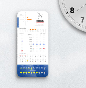
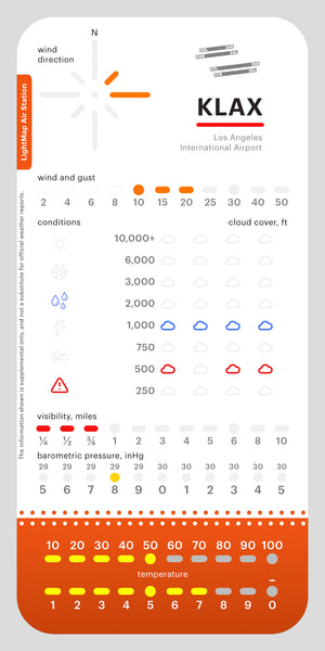
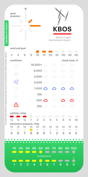
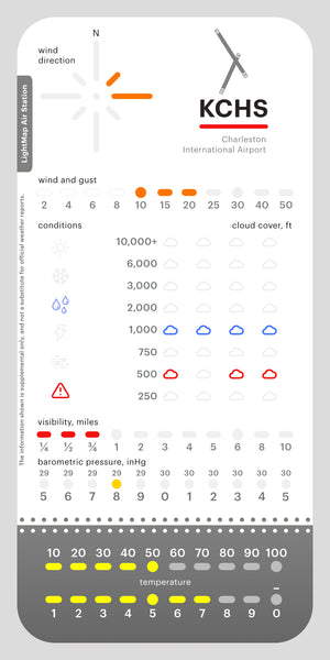


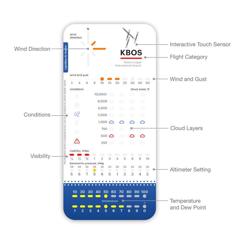


the sea map (simple one) is excellent. Quite a bit on info provided with just a quick glance, plus it looks cool.
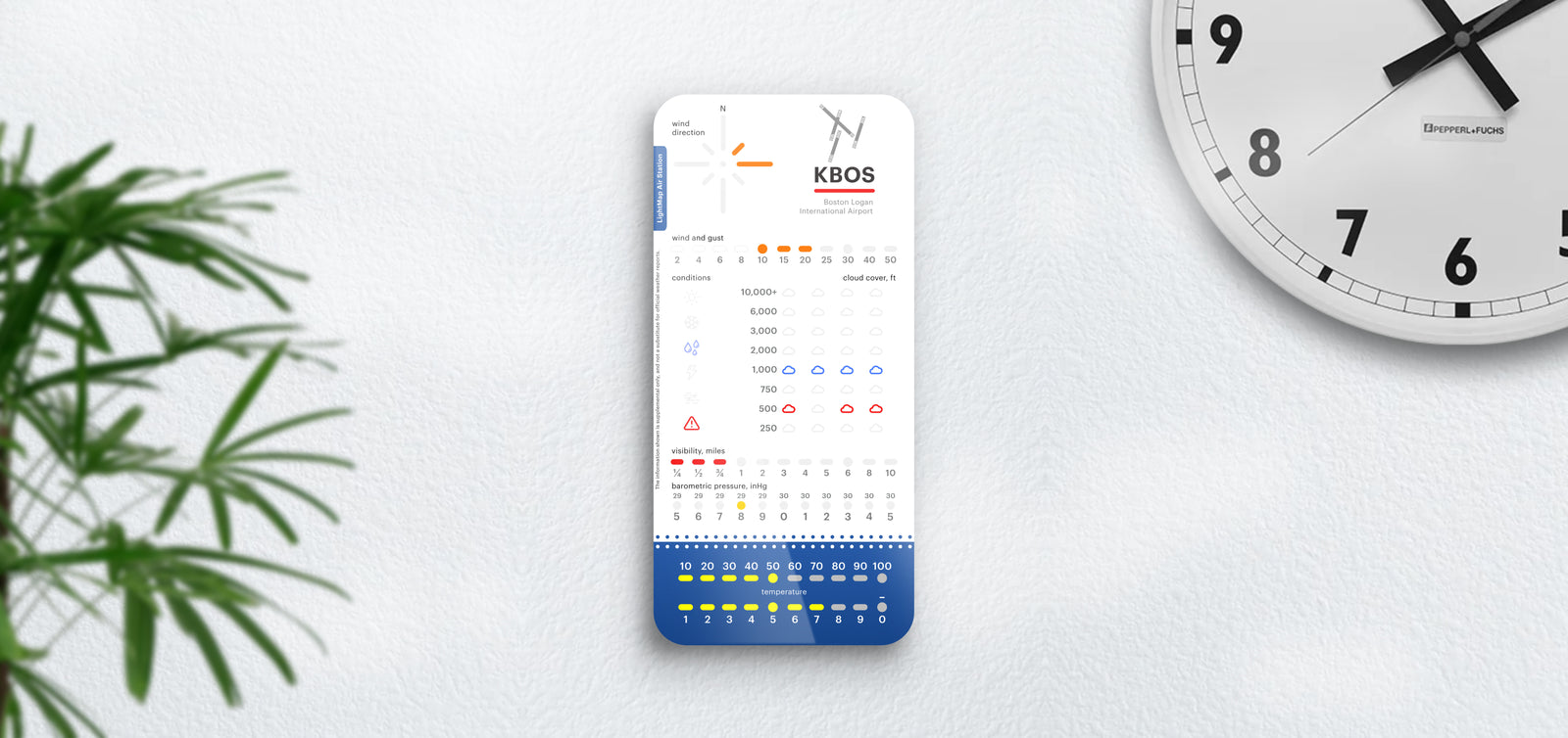
I am a recreational sailor in Edgartown. I have a windy app on m phone but this item has far more information. The best thing is that you can place the point of origin for the information anywhere, so you have a very accurate reading of where you will be sailing. The lights adjust to the brightness in the room and are very colorful. Set up is a breeze. i highly recommend this product.
Was going to put it in the kitchen but like it so much it ended up in my shop. Guess I need to buy another one, oh darn.
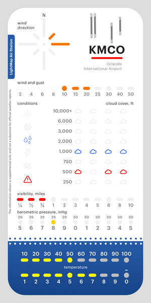
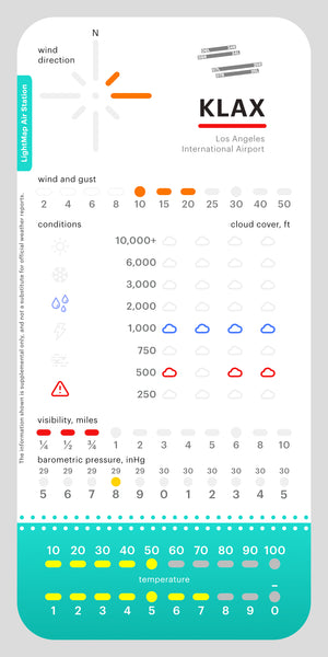
Works perfectly with my Tempest Weather Station. Looks great hanging on the wall! Easy to read and plenty of information provided